Although we all enjoy adventures, I have to be honest, the wild demands both skill and reliable tools. My experience has taught me that while instincts are valuable, tangible navigational aids are indispensable.
In this exploration of survival navigation, we’ll focus on three core instruments: the compass, map, and GPS.
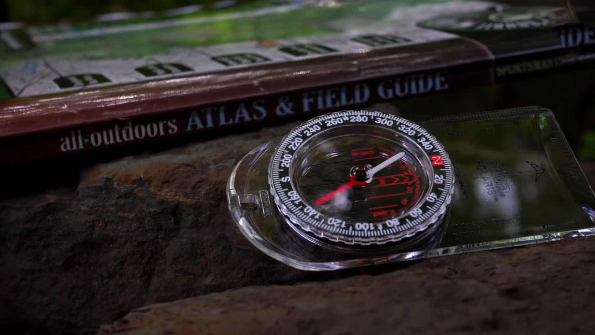
Magnetic Compass: Basics and Benefits
When you’re somewhere in the wild, skills like being able to use navigation tools or tying secure knots can be lifesaving.
The magnetic compass is your stalwart partner in the backcountry. Just like survival multi-tools can be used for different tasks on your trip, these tools can be used in different settings – from the frozen Arctic to the scorching desert.
Key Features
- The magnetic compass, a navigator’s old faithful, doesn’t require batteries, signals, or updates to function.
- Its magnetic needle aligns with Earth’s magnetic field, pointing toward magnetic north.
- The simplicity of its design is its greatest strength, providing direction when all else fails.
- Its durability and reliability mean that in the hands of someone with basic navigational knowledge, it can be the difference between getting lost and finding your way.
Benefits
- Orienting the Map: A compass is used to align your map with true north, creating a point of reference from which you can navigate.
- Taking Bearings: With a compass, you can take a bearing from a map or in the field, guiding you in a straight line toward your destination.
- Cross-Country Navigation: In the absence of trails, a compass allows for cross-country navigation, enabling you to maintain a consistent direction over varied terrain.
Advanced Compass Techniques
While a compass points toward magnetic north, true navigators need to adjust for the difference between magnetic north and true north—known as magnetic declination.
This variance changes depending on where you are on the globe, and failing to adjust for it can lead to significant errors in navigation.
| Survival Technique | Description |
|---|---|
| Triangulation | Use bearings from multiple known points to pinpoint your location on a map. |
| Tracking Back | Reversing your bearing with a compass to retrace your steps and return to your starting point. |
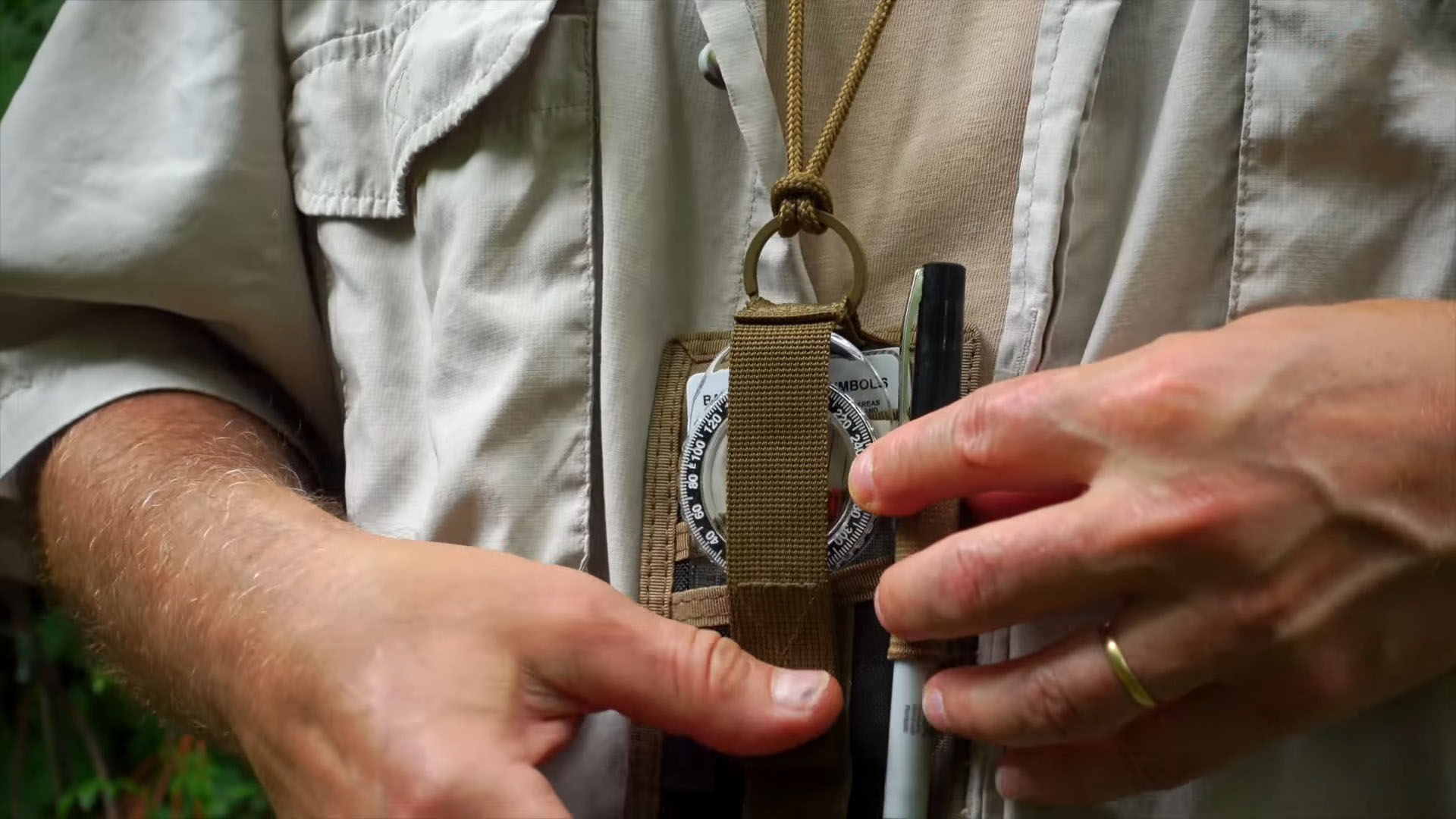
Maintenance and Considerations
A compass must be well-maintained and understood.
- Regularly inspect your compass for bubble formation, which can indicate a leak and affect accuracy.
- Always keep it flat when taking a bearing and away from metal objects that could interfere with the magnetic needle.
- If you travel globally, consider a globally balanced compass to account for variations in Earth’s magnetic field.
- Protect your compass from drops, extreme temperatures, and chemicals, which can all compromise its integrity.
While ensuring you have the right navigational tools is crucial for wilderness adventures, don’t overlook the importance of a well-crafted hunting knife, especially one that balances durability and precision, like the ones we’ve highlighted in our comprehensive review.
The Fundamental Map
A map is a visual storyteller, providing a snapshot of the terrain, potential hazards, and key landmarks. It allows for strategic planning and can reveal the safest and most efficient routes.
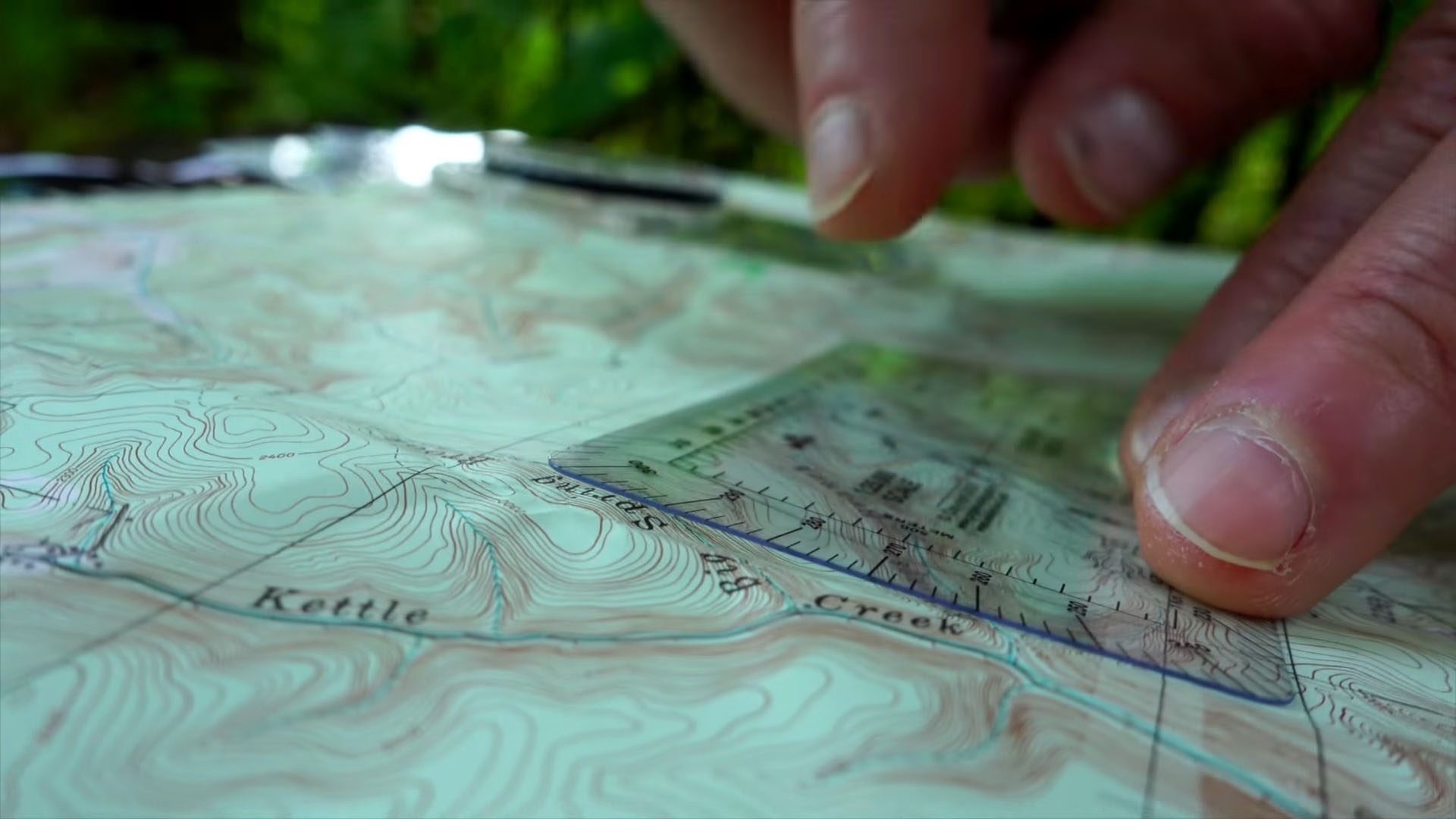
Topographic Maps
Topographic maps are vital for understanding the physical landscape. They use contour lines to depict the elevation and shape of the terrain, which can indicate the difficulty of the terrain you’ll encounter.
- Contour Lines: Close contour lines indicate steep terrain, while wide spaces suggest gentle slopes.
- Color Codes: Maps use standardized colors: blue for water, green for vegetation, and white or yellow for open land.
Navigational Strategies
Maps serve as a crucial planning tool before and during your journey. They help you identify water sources, and shelter areas, and can even aid in signaling for help by guiding you to clearings or high ground.
Before setting out, map out your journey, identifying waypoints and potential resupply points. Use large, unmistakable land features to confirm your location and the direction of travel.
Preserving Your Map
Your map is only as good as its condition. Here are a few tips on how to preserve it:
- Keep it in a waterproof case or laminate it for durability.
- Learn to fold it efficiently for quick access to the relevant section without exposing it to the elements unnecessarily.
- Update your map with any new information or changes in the landscape, such as new trails or washed-out bridges.
- Marking your route, camp locations, and water sources can be invaluable during your expedition and for any future journeys.
The Modern GPS
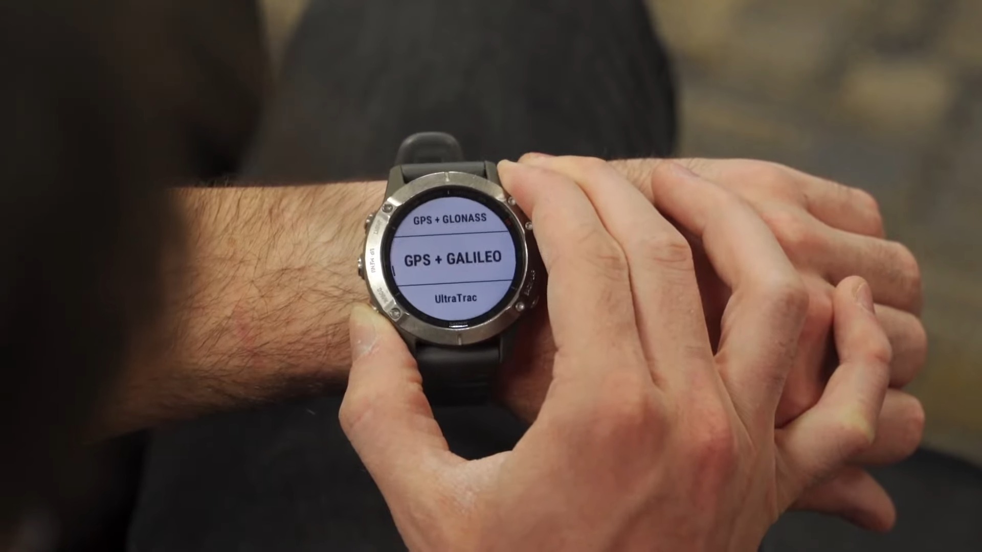
GPS devices harness the power of satellites to pinpoint your location anywhere on Earth, often within a few meters. They offer real-time navigation and a multitude of functions that can be life-saving in the wilderness.
How It Works and What It Offers
A GPS receiver calculates your position by timing signals from a network of satellites. The more satellites it can “see,” the more accurate your location will be. GPS provides coordinates in various formats, making it compatible with maps worldwide.
Modern GPS devices allow you to set waypoints and record your track, ensuring you can find your way back or continue on a known path.
Advanced Features
Beyond simple location fixes, GPS units can offer topographic maps, integrate with your smartphone, and even send emergency signals in some advanced models.
- Altimeters and Barometers: These features provide additional data about your elevation and the coming weather, aiding in decision-making.
- SOS Functions: Some GPS units have built-in SOS functions that can signal for help, a critical feature when time is of the essence.
Maximizing GPS Utility While Minimizing Risks
As sophisticated as GPS devices are, they are not foolproof. Batteries can die, signals can get lost, and electronic failure is always a risk in harsh environments. Always carry extra batteries or a solar charger to keep your device powered.
Also, use your GPS in conjunction with a map and compass for redundancy; if one fails, the other can take over.
FAQs
Can a smartphone GPS function as reliably as a dedicated GPS device in wilderness settings?
While smartphones have GPS capabilities, they typically rely on a combination of satellite signals and cellular networks for accurate location tracking. In remote wilderness settings, where cellular signals are weak or non-existent, a dedicated GPS device, which only relies on satellites, tends to be more reliable.
Additionally, dedicated GPS devices are often more rugged and have better battery life than smartphones.
How can I ensure my magnetic compass stays accurate over time?
To ensure the accuracy of your magnetic compass, store it away from electromagnetic fields and metals that could affect its magnetism. Regularly check for air bubbles in the liquid housing, which can indicate a leak or damage.
Also, test its accuracy against a known bearing or in an area where you can confirm the compass is pointing to magnetic north.
Besides maintaining your compass, it’s equally important to maintain your survival gear, such as keeping your hunting knife razor-sharp, a skill you can master with the right techniques and tools, as we’ve explored in our detailed guide.
What should I do if my GPS device starts giving erratic readings?
If your GPS device starts to give erratic readings, ensure it has a clear view of the sky, free from obstructions like dense foliage or deep canyons. Check that the device’s software is up to date. You can try restarting the device to reset the connection with GPS satellites.
If problems persist, switch to using a map and compass and troubleshoot the device when you’re in a secure location.
Is it possible to determine elevation using just a map and compass?
While a map and compass won’t give you a digital readout of your elevation, you can use a topographic map’s contour lines to estimate your altitude. By finding your location and identifying the contour line you are on, you can determine your approximate elevation above sea level, as each line represents a specific altitude.
How do I choose the best type of compass for mountainous terrain?
In mountainous terrain, a sighting compass is often the best choice. It allows for more precise navigation by letting you aim directly at landmarks and read the bearing from the dial.
Additionally, a compass with adjustable declination can save time by eliminating the need to manually calculate the difference between magnetic north and true north.
Can heavy cloud cover affect the performance of a GPS device?
GPS signals are relatively robust and can penetrate clouds, rain, and other weather conditions; however, heavy cloud cover can sometimes slightly decrease the accuracy of a GPS unit. The effect is generally minimal, and most users won’t notice a significant impact on the device’s performance.
The Bottom Line
In summary, mastery over these navigational tools – compass, map, and GPS – can greatly enhance your safety and efficiency in the wild. Each tool has its strengths and limitations, and the savvy survivor knows how to wield each one effectively.
Personally, I lean towards the classic compass and map for their unfailing utility and the way they engage one’s senses with the environment. However, the GPS has earned its place in my pack for its precision and real-time data.
When you use them together, they make a great team for navigating in the wild. They help you stay on track and find your way even if things don’t go as planned. This way, you can explore the wilderness with more confidence.
My name is Casey Harper, and I specialize in wilderness survival, navigation, and first aid. With over 12 years of experience as a wilderness survival instructor, I have had the privilege of guiding individuals and groups through challenging outdoor environments, ensuring their safety and teaching them essential survival skills. Additionally, I contribute to GearDisciple by writing insightful articles on survival strategies and reviewing outdoor gear. Through sharing my knowledge and experience, I aim to equip others with the skills and tools necessary for thriving in the wild, embracing the beauty and challenges it presents.